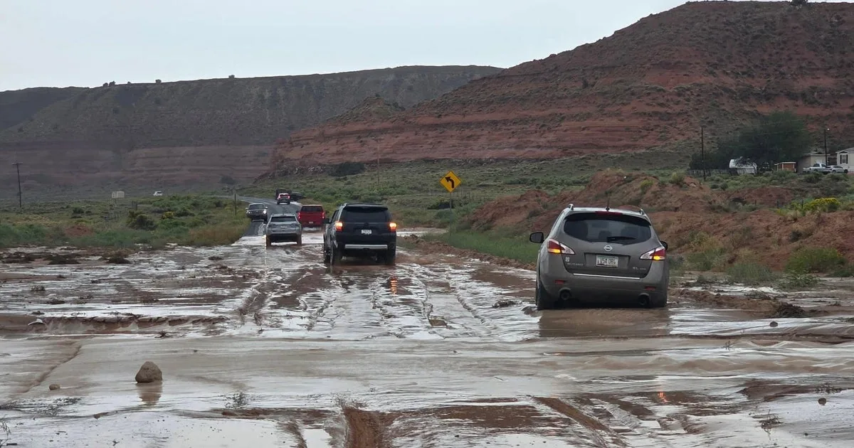
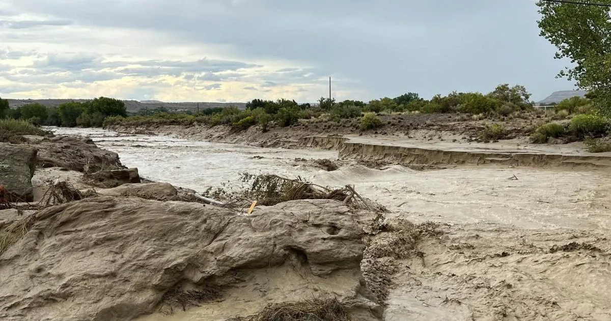
SANTA FE, NM — Storm chances are expected to taper off this weekend after several days of widespread rain brought flooding to parts of New Mexico, including the Shiprock area and communities farther south. In northwestern New Mexico, the Navajo Police Department ordered temporary evacuations near the San Juan Bridge in Shiprock after water rose over the riverbank.
Officials linked the flooding to repeated rounds of rain across northwestern New Mexico and southwestern Colorado. Navajo police urged people to avoid crossing overflowing water and stay away from fast-moving currents, warning that river water can be more forceful than it looks. The flooding comes as parts of the state continue dealing with wet ground, road concerns and lingering impacts from earlier storms.
Shiprock evacuation order follows deadly flooding near Newcomb
The Shiprock action came just days after Navajo police said three people, including a child, died after being swept away in floodwaters early Wednesday near Newcomb. The back-to-back emergencies have underscored how quickly heavy rain has turned dangerous in the region this week.
Navajo Nation President Buu Nygren also signed an emergency declaration Friday to address ongoing flooding impacts. In a Facebook post, he said sections of road in Mexican Springs had disappeared. The declaration reflects the broader strain on roads, drainage and emergency response across the Navajo Nation as runoff continues to move through low-lying areas.
Officials have not said how long the Shiprock evacuation order will remain in place. The temporary measure was tied specifically to rising water near the bridge, where conditions were considered unsafe for nearby residences.
Santa Fe County gets more than three inches in places
While the heaviest impacts were farther north, the Santa Fe area also saw unusually strong rainfall. Some parts of Santa Fe County received more than 3 inches of rain over a three-day period, according to meteorologist Todd Shoemake with the National Weather Service in Albuquerque.
Shoemake said a spot in Madrid reported 3.4 inches, while an area southwest of the Santa Fe Regional Airport measured 3.07 inches. He noted that the moisture was striking after a summer marked by historic dryness. For Santa Fe, the normal amount of rain during the redefined monsoon season from mid-June through the end of September is about 5.5 inches.
“There’s some places that got almost that much in just about four days,” Shoemake said. “So, yeah, that’s very considerable.”
Transportation crews watch for potholes and pavement damage
The New Mexico Department of Transportation said Friday afternoon it had not received reports of major road damage in the Santa Fe area. Even so, spokesperson Kristine Bustos-Mihelcic said drivers could still encounter surface problems caused by the rain.
In an email, she warned motorists may notice “potholes and other pavement damage developing or becoming more pronounced” after the recent rainfall. That kind of damage can show up after water saturates roads and weakens already stressed pavement.
The warning came as agencies across the state kept an eye on flood effects and runoff. In areas with repeated storms, even where roads remain open, conditions can change quickly once water drains and traffic begins to expose new breaks in the surface.
Runoff reaches Santa Cruz Lake as officials test the water
Heavy rain also sent sediment toward Santa Cruz Lake in the foothills of the Sangre de Cristo Mountains in northern Santa Fe County. Santa Cruz Irrigation District Chair Ron Gallegos said the runoff came from the north and south and appeared to be a cleaner type of sediment, without the black ash from the nearby Frijoles Fire.
Gallegos said the U.S. Bureau of Land Management was testing water quality in the lake and that pH tests were still pending. The concern had been that high sediment loads and debris from the fire could move into the lake through the Rio Medio, which supplies nearly half its water.
Rain this week has also helped dampen the fire, which is still burning on Santa Fe National Forest lands near Cundiyó and in the Pecos Wilderness. Recent soil testing showed low burn severity across much of the burn scar, a sign that the outlook for lake impacts may be better than feared.
Ruidoso sees familiar summer flooding but less severe damage
Farther south, social media posts on Thursday showed muddy water rising around cars and businesses in Ruidoso. Village spokesperson Kerry Gladden said the flooding in recent days was “very typical for this summer” and affected Upper Canyon, Brady Canyon and Perk Canyon with debris and sediment.
Gladden said crews had equipment staged so they could clear debris quickly when flooding hits. She added that the village has not seen the same level of damage that struck in the last two summers. Two fast-moving fires in 2024 burned about 25,000 acres, destroyed roughly 1,400 structures and killed two people.
Floodwaters arrived before those fires were even fully extinguished and kept hammering the town after that. A deadly flash flood also struck in July 2025, keeping Ruidoso residents on edge during another storm season.
Dryer air expected Sunday before rain returns next week
The flood watch for a large section of western New Mexico and the Ruidoso area was set to expire at midnight Friday. Shoemake said much of the state should get a drier stretch starting Sunday, but another round of rain is expected to return Tuesday.
He said precipitation chances will stay at or above 40% across the state through at least Sept. 25. Along with the moisture, temperatures are expected to feel more like fall. Santa Fe is forecast to reach only 67 degrees Wednesday.
Shoemake said the cooler pattern is tied to the extra moisture in the air and the cloud cover that comes with it. For now, the state is moving from flood concerns toward a brief break, even as officials continue monitoring roads, lakes and fire-scarred terrain.